
When a study is required
NEN 8100 includes a decision model for when wind must be assessed: buildings taller than 30 metres always, buildings between 15 and 30 metres when an expert judges the situation sensitive, for instance an exposed location or an unusually open corner. It also prescribes how the assessment may be done: wind tunnel testing or CFD simulation, with quality requirements for both.
This is the standard’s real achievement: a developer, an architect and a municipality reading the same report agree on what was computed and what the grades mean. Belgium has no equivalent, so NEN 8100 is the de facto reference in Flemish and Brussels practice as well.
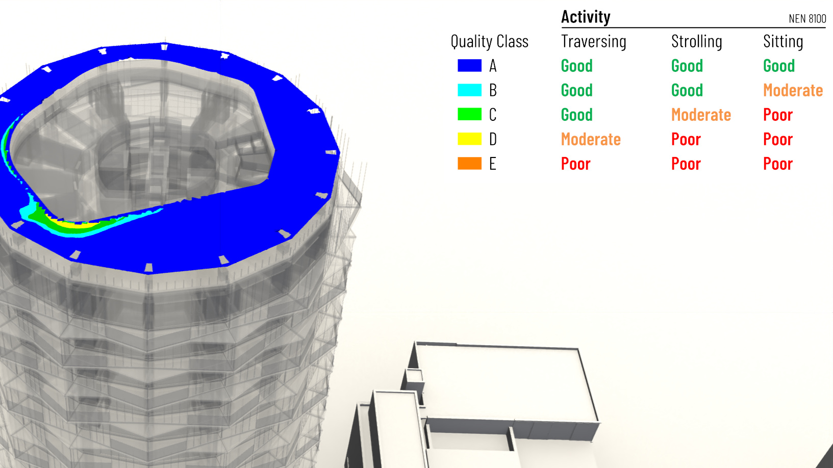
The five grades
Everything hangs on one threshold: an hourly mean wind speed of 5 metres per second at pedestrian height. Each location is graded by the percentage of hours per year that threshold is exceeded. Grade A means less than 2.5 percent, B up to 5, C up to 10, D up to 20, and E more than 20 percent of the year.
The grade is then judged per activity. For walking through an area, grades A to C are good and D is moderate. For strolling, C is already moderate and D poor. For sitting outside, only A is good, B is moderate, and C or worse is poor. One map therefore answers three different questions: where people can pass, linger, and sit.
The danger criterion
Separately from comfort, the standard defines wind danger using a 15 metres per second threshold. If it is exceeded between 0.05 and 0.3 percent of hours per year, the location carries limited risk; above 0.3 percent it is classed dangerous. Dangerous locations are unacceptable on routes people must use, and limited risk demands a conscious decision, not a shrug.
In practice, danger failures cluster at the corners of tall buildings. They are also the finding that municipalities weigh most heavily in a permit review.
Where this shows up in our work